Lost at Sea?
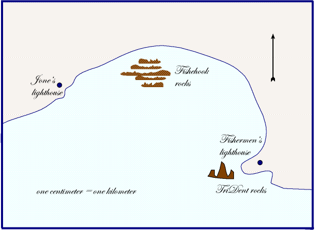
On a dark and stormy night a radio operator heard a distress call from a ship captain that her ship was taking on water and needed assistance. However, the ship's location was given as five km from Jone's light and eight from Fisherman's light. The way that the information was given caused the radio operator to question its authenticity. However, due to the seriousness of the possible situation a search and rescue operation was started.
Your task is to mark the search area(s) on the map below. Mark the area(s) that you believe is/are the most likely position(s) of the ship. Provide an explanation for your position(s) choice.
Sea Coast map
(Hint:
Strategy: Find the possibe location(s) of where a ship would be five km from Jones’s lighthouse and eight km from Fisher’s lighthouse.
Information needed: Map, scale 1 cm = 1 km, five km from..., eight km from...,
Procedure:
Dr. Robert Sweetland's Notes ©